

Texas Environment | Natural Resources | Texas Fun Facts
Padre Island Is Slowly Moving Toward the Texas Mainland, One Grain of Sand at a Time
The National Park Service says wind, waves and storms continually reshape the barrier island. The protected shoreline also separates the Gulf of Mexico from one of the world’s few hypersaline lagoons.
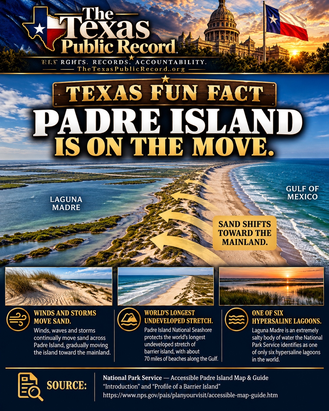
PADRE ISLAND, Texas — The coastline on a map may appear permanent. Roads, beaches and waterways are drawn in place, giving the impression that the land beneath them will remain where it has always been.
But along Padre Island, the ground itself is slowly moving.
According to the National Park Service, wind and storms continually redistribute sand across the barrier island, gradually pushing its landscape toward the Texas mainland. It is a natural process that unfolds over time, often too slowly to notice during an ordinary visit.
The island may look much the same from one summer to the next, but its dunes, beaches and sandy terrain are part of a constantly changing coastal system.
And that movement is not a defect in the landscape. It is part of what makes a barrier island a barrier island.
A coastline that never stands still
Padre Island stretches along the southern Texas coast, with the Gulf of Mexico to its east and Laguna Madre to its west.
The narrow strip of land serves as a natural separation between the open Gulf and the shallow waters behind it.
Unlike landscapes anchored by solid bedrock, barrier islands consist largely of sediment that can be redistributed by waves, wind, currents and storms.
Sand moves along beaches, across dunes and into lower areas of the island. Strong storms can accelerate those changes, reshaping shorelines and moving sediment inland.
The National Park Service explains that these forces cause Padre Island to creep slowly toward the mainland.
That does not mean the entire island moves as one solid piece, or that every section advances at the same rate. The movement occurs as sand is eroded from some areas and deposited in others.
Over time, those changes can alter the island’s shape and position.
For visitors, the result may be a different beach profile, a reshaped dune or a stretch of sand that looks unlike it did years earlier.
For coastal scientists and land managers, those changes are part of the natural behavior of the barrier-island system.
The world’s longest undeveloped barrier-island stretch
Padre Island National Seashore protects approximately 70 miles of coastline along the Gulf of Mexico.
The National Park Service identifies the protected area as the world’s longest undeveloped stretch of barrier island.
That distinction matters because much of the coastline remains subject to the natural forces that formed it.
Wind can rebuild dunes. Storms can move sand across the island. Waves and tides continually reshape the shoreline.
The national seashore preserves an extensive portion of that dynamic coastal environment, providing opportunities to observe processes that can be more difficult to recognize along heavily developed shorelines.
The word undeveloped, however, does not mean untouched by people. The park supports public recreation, vehicle access in designated areas and management activities.
Its significance lies in the preservation of a long, largely natural barrier-island landscape.
Laguna Madre: An unusually salty body of water
On the western side of Padre Island lies another remarkable feature of the Texas coast.
Laguna Madre is a shallow coastal lagoon separated from the Gulf by the barrier island.
The National Park Service identifies it as one of only six hypersaline lagoons in the world.
Hypersaline means its water has a salt concentration greater than that of ordinary seawater.
Laguna Madre’s shallow waters, high evaporation and restricted exchange with the Gulf contribute to its unusually salty conditions.
That makes the lagoon a distinctive coastal environment, one shaped by the relationship between water, climate and the barrier island that separates it from the open Gulf.
Padre Island and Laguna Madre are therefore not independent features. They are connected parts of the same coastal system.
As the barrier island changes, it also helps shape the physical environment of the waters behind it.
Why a moving island matters
Barrier islands perform an important protective function along coastlines.
By standing between the open ocean and the mainland, they can absorb and reduce some of the energy associated with waves and storm tides.
But that protection comes from a landscape that is itself vulnerable to the same forces.
Major storms can erode beaches, flatten dunes and move substantial quantities of sand. Some changes may be reversed through natural sediment movement, while others can persist.
That creates a continuing challenge for coastal communities and land managers: the features that help shield the mainland are not permanent structures.
They are living geological systems, constantly responding to their environment.
The National Park Service’s description of Padre Island’s slow movement offers a reminder that a coastline should not be understood as a fixed boundary simply because it appears that way on a map.
The island’s shape today is the result of natural processes that continue to operate.
A different way to see Padre Island
For many Texans, Padre Island is associated with beaches, fishing, wildlife and the open waters of the Gulf.
Its geological story is less immediately visible.
The sand beneath a visitor’s feet may have been carried by wind, shifted by waves or deposited by an earlier storm. The dunes visible today may change shape as the next season’s weather moves across the coast.
Behind the island, Laguna Madre remains one of the world’s unusually salty coastal lagoons. Beyond it lies the Texas mainland, partly shielded from Gulf conditions by a barrier that is continuously being reshaped.
None of this requires the island to move quickly enough for a person to watch it happen.
The change becomes apparent across longer periods, through the cumulative movement of countless grains of sand.
Padre Island is not disappearing simply because its sand moves. Nor is it permanently fixed in the position shown on today’s maps.
It is doing what barrier islands naturally do.
Along this stretch of the Texas coast, the land itself is always traveling, one grain of sand at a time.
Sources
- National Park Service — Accessible Padre Island Map & Guide, “Introduction” and “Profile of a Barrier Island”: island movement, roughly 70 miles of protected coastline, undeveloped barrier-island designation and hypersaline classification
- Texas Parks and Wildlife Department — Upper Laguna Madre: evaporation, restricted Gulf exchange and hypersaline conditions
Verified October 22, 2026. The description of “one of six” is attributed to NPS’s guide; it is not a new global census of lagoons.
EDITORIAL NOTICE: Submit documented corrections or updates. Material errors will be corrected transparently.
The Texas Public Record
Rights. Accountability. Awareness.
TheTexasPublicRecord.org